


In collaboration with Esri, Boeing subsidiary Insitu has completed unmanned aircraft systems (UAS) test flights and subsequent firefighting support in Oregon.
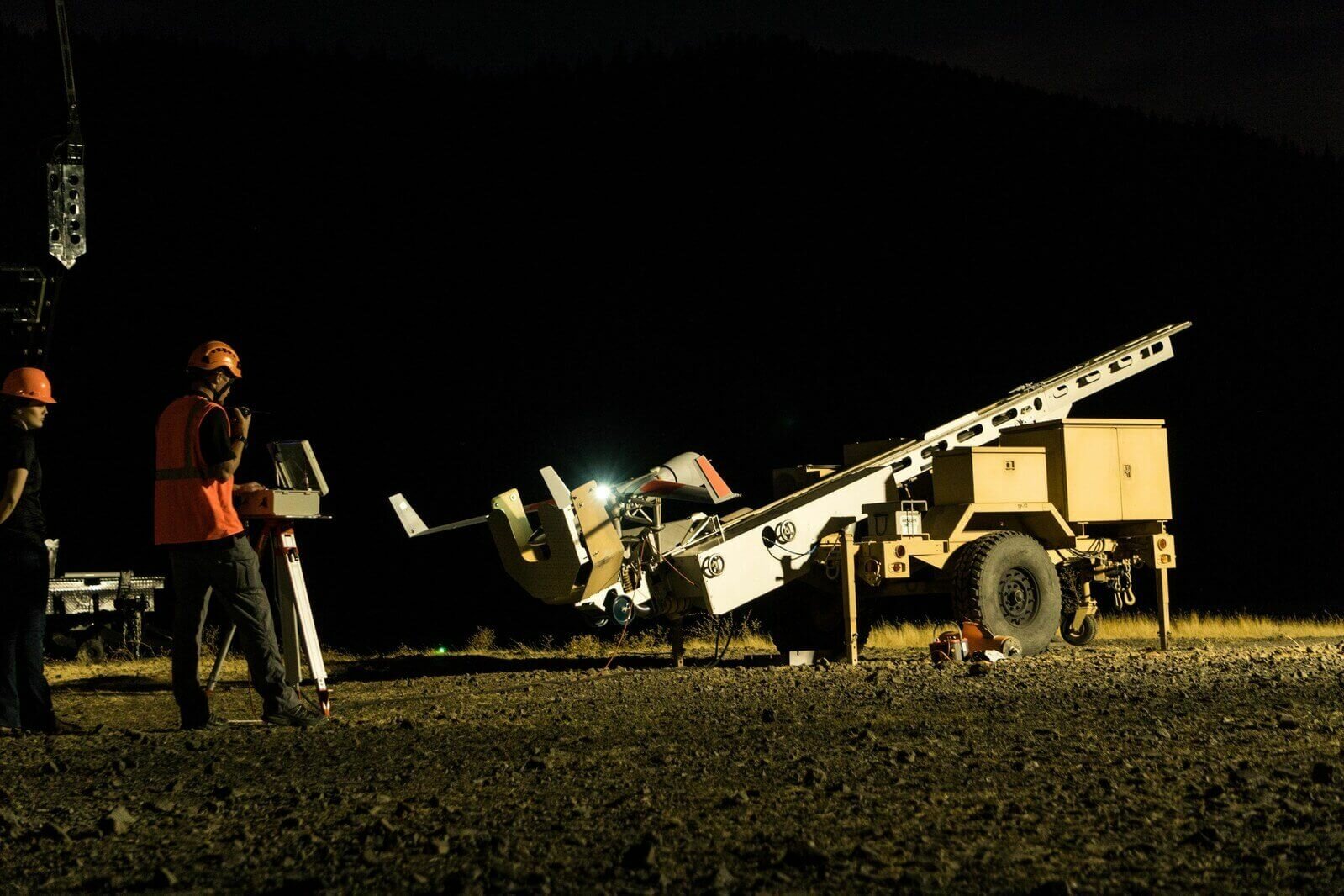
The test flights were held at the Warm Springs drone test site, a member of the Federal Aviation Administration (FAA)-designated Pan Pacific UAS Test Range.
A week after successfully completing customer-acceptance test flights, Insitu deployed its INEXA Solutions aerial remote sensing teams to aid firefighters in suppressing the Eagle Creek fire.
Collaborating with customers to identify business challenges, INEXA Solutions professionals use an expanding suite of capabilities such as INEXA Control (ground-based command and control); INEXA Cloud; INEXA manned and unmanned air vehicles, including ScanEagle; and INEXA sensors and analytics.
Coordinating with the Oregon Department of Forestry and other governing entities, Insitu’s ScanEagle system provided near real-time data for first responders, resulting in heightened emergency response efforts, increased situational awareness and safety, and supported planning and resource allocation. Equipped with a number of different sensors, the ScanEagle surveyed fire lines at night over the Eagle Creek wildfire, which had spread to nearly 49,000 acres throughout the Columbia River Gorge region.
“Throughout the difficult Eagle Creek wildfire, our thoughts have been with our friends and neighbors impacted by this unfortunate event,” states Mark Bauman, vice president and co-general manager at Insitu Commercial. “We stand prepared to assist local authorities with ongoing operations in any way we can, and we extend our gratitude to all of those working hard to contain the fire.”
The ScanEagle can supplement manned firefighting fleets by operating during dense smoke and at night, when manned aircraft typically cannot fly, explains Insitu. Infrared camera technology is used to penetrate smoke and gather and disseminate geo-referenced images of points of interest. These images allow geographic information system (GIS) specialists to perform analysis using Esri’s ArcGIS software.
As the sole aviation over watch within the temporary flight restriction, the ScanEagle provided persistent nighttime oversight and monitored the progression of the fire. Insitu coordinated manned and unmanned aviation assets, and through data collection, analysis and integration capabilities, it produced near real-time georeferenced spatial data (maps tied to specific known locations). Thus, incident commanders, firefighters and first responders had data that delivered updated incident perimeter maps, identified spot fires, located fire lines and hotspots, and provided near real-time video feed and still images of infrastructure.


