


There’s a construction boom taking place across Qatar, and Arcadis is helping make it possible. The global engineering consultancy, which has over 27,000 employees in 350 offices across the world, leads infrastructure development projects across Qatar, helping the country meet ambitious construction goals for the 2022 FIFA World Cup and for its 2030 National Vision.
Arcadis recently had the opportunity to put drones to work on a project of a massive scale: Contract 2 of the Orbital Highway in the city of Doha – a 14-lane road with five vehicle lanes and two dedicated truck lanes going in each direction. The Orbital spans 46 kilometers in total, and construction will be finished in 2018.
Arcadis was the lead designer of the Orbital, but their emerging drone operations presented a new business opportunity for this project.
The client, Qatari Diar Vinci Construction (QDVC), a joint venture company between Qatari Diar and Vinci Construction Grands Projets, wanted fast, accurate volumetric calculations for the earthwork spread throughout the entire roadway.
“Our main deliverable for this project was volumetric calculations,” says Paul Kawuma, innovation and infrastructure BIM manager at Arcadis.
Putting drone surveying to the test
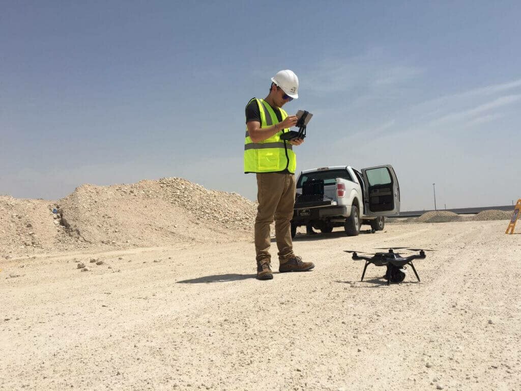
Arcadis is a pioneer of using drones for engineering purposes in Qatar, and they thought the size of the site and specific goals of the project would be a perfect fit for a drone survey. However, in order to win the project to survey the whole highway, they first had to prove they could get accurate volume calculations from drone surveys compared with traditional methods.
They chose a three-acre area that was representative of the rest of the site and performed a test survey with both methods. Arcadis decided to use the 3DR Site Scan drone data platform, with its high-resolution 20.1MP Sony R10C and Autodesk integration, in order to bid on the project.
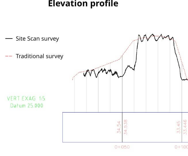
Ultimately, the traditional survey took three hours, but the drone survey took just 20 minutes. The drone captured substantially more data points, too: While the traditional method captured 197 points, Site Scan was able to capture 1,539,964 points. As the profile line shows, this created a major difference in the level of detail:
Because volume measurements were the initial focus, relative accuracy was most important, rather than the absolute location on Earth. That’s why Arcadis decided to compare data that Site Scan processed without the use of ground control points, even though they would have helped improve accuracy even further.
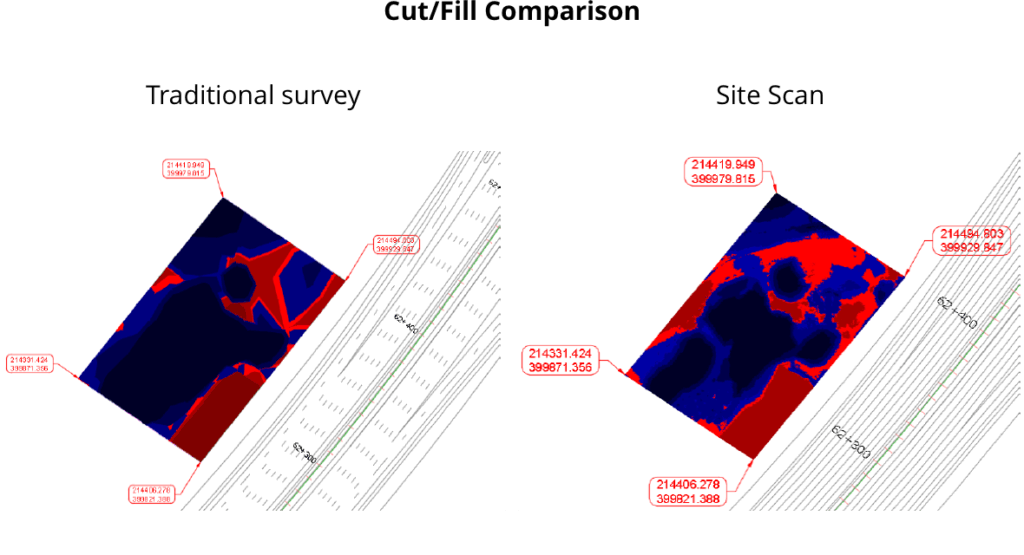
The sheer volume of points sampled by Site Scan also helped deliver more accurate earthwork volume quantities compared with a traditional survey:
After successfully demonstrating how much faster and more detailed their drone surveys were, QDVC gave Arcadis the go-ahead for the project.
With certified drone operators and a fleet of Site Scan units, they started their work by setting ground control points in order to improve the accuracy of their end deliverables. They flew automated nadir surveys with the drone; uploaded the photos to Site Scan Manager; and then entered, tagged and processed ground control points in the cloud.
In total, the Arcadis team created 34 unique drone maps – known as orthomosaics – using Site Scan’s multi-engine processing capabilities. They then exported their drone data into LAS and TIFF files and used them to generate raster data and their surfaces in Civil 3D in order to produce volumetric calculations.
Liam Kirk, business director at Arcadis, says, “In the market we’re in, we’re realizing that drone surveys can be done 10 times faster than traditional topographic surveys. While we continue to work with licensed surveyors to collect control points and validate accuracy, the drone is a great addition to our platform.”
Kawuma adds, “The drone data was more accurate than a traditional survey when it comes to working on volumes because it catches more points. This gave us a really dense point cloud compared to the five-meter grid (separation of points) that we usually get with a traditional survey. This made our client far more comfortable deciding to go with the drone, and ultimately, it delivered the results we needed: They were able to use this detailed data to make better, more informed decisions about the project, identify issues and risks quicker, and get a better understanding of future challenges they may face on the project.”
This article was adapted and reposted with permission from a blog post by 3DR. Hugh McFall is a writer at 3DR.


