D&T Excavation, an Oregon-based earthworks company serving commercial, residential and government agencies, has selected the Kespry drone platform to safely perform comprehensive inventory management and worksite topographical analysis.
According to Kespry, D&T Excavation conducted a comprehensive survey of available industrial drone options and chose Kespry following a recommendation and demonstration from its strategic equipment partner, Papé Machinery, a member of the John Deere dealer network. Kespry and John Deere have a partnership to provide the Kespry aerial intelligence platform through the John Deere Dealer Network worldwide.
“Everyone’s biggest nightmare is to bid a job and then find out that it’s something different than what you’re expecting,” says Dan Liechty, project engineer at D&T. “A lot of times, the existing contours or elevations we’re getting from an engineer could be outdated or based on some inaccurate, not-detailed survey techniques. There’s supposed to be all this dirt there, and then it ends up not being there. With Kespry, we can go out there and verify it without spending two or three days doing a topographical analysis with a GPS base and rover.”
D&T also keeps its customers informed about worksite project progress through the Kespry aerial intelligence platform’s comprehensive analytics and reporting capabilities.
“We saw the benefit of being able to invite customers to look at specific jobs and their progress, as well as orthomosaic photographs from the cloud,” continues Liechty. “From our research, we saw Kespry was the most complete, end-to-end solution. We think this is the future. Everyone’s going to be using something like this.”
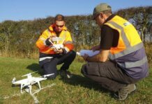
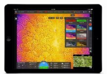
With the Kespry platform’s autonomous drone technology, operators select the survey area and set the flight parameters on an iPad application. Then, the autonomous Kespry Drone and Kespry Cloud do the rest.
“Using Kespry means more safety and saving time,” adds Liechty. “It’s a huge pain to send somebody to the top of a rock stockpile and come down two or three hours later to end up with 15 topographical points, compared to the hundreds or thousands we get with the Kespry Drone.”


