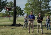
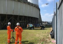
Callinex Mines Inc. has completed a 450 line-kilometer drone survey, providing high-resolution data over the current mineral resources at the company’s Nash Creek Project within the Bathurst Mining District of New Brunswick.
According to the Vancouver, British Columbia-based company, the Nash Creek deposit is related to structurally controlled, near-vertical faults that channeled fluids before dispersing laterally as flat-lying stratabound zinc-lead-silver mineralization. The drone magnetic survey was completed to help identify and delineate these near-vertical faults.
Systematic completion of additional drone magnetic surveys – if proven successful -will be essential to the discovery of new deposits within the land package in an upcoming 2018 drill program, the company says.
The Nash Creek Project covers several high-grade zinc occurrences over a 20-kilometer-long (approximately 12.4-mile-long) trend. This highly prospective land package, which has had very little exploration work completed, represents an opportunity for Callinex to discover additional zinc-rich deposits. The implementation of modern geophysical techniques, including drone magnetic, LIDAR and induced polarization surveys, along with conventional prospecting and soil sampling methods, will assist in identifying the most prospective areas for new discoveries, according to Callinex.
Callinex has also engaged a geological consulting firm to complete a structural interpretation of the Nash Creek area based on the drone survey data, along with a 2016 LIDAR survey flown at one-meter contour intervals. An initial in-house review of the 2016 LIDAR data shows that several key geological structures are identifiable.


