Global telecommunications company Vodafone has commenced trials of its 4G Internet of Things (IoT) drone tracking technology, designed to protect manned aircraft from drone collisions and prevent inadvertent or criminal drone incursions at sensitive locations, such as airports, prisons and hospitals.
The company says its radio positioning system (RPS) uses a 4G modem and SIM embedded within each drone to enable the following:
- Real-time tracking of each drone (with up to 50-meter accuracy) by drone operators and authorized bodies, such as air traffic control;
- Over-the-horizon/beyond-line-of-sight control by the operator – reducing the risk of accidental incursions when operators lose sight of their drones;
- Protective geofencing, with drones pre-programmed to land automatically or return to the operator when approaching predetermined exclusion zones (such as airports and prisons);
- Emergency remote control intervention to provide the authorities with the means of overriding a drone operator’s control to alter the drone’s flight path or force it to land; and
- SIM-based e-identification and owner registration.
According to Vodafone, 4G mobile networks operate with long-established and proven security systems, including strong end-to-end encryption over-the-air from SIM to base station. In addition, the company says RPS location data is significantly harder to hack or spoof than GPS location data, and the data connection used to control the drone offers the operator significant advantages over current drone radio control protocols, including greater resilience and over-the-horizon, real-time feedback.
The Vodafone RPS is combined with artificial intelligence algorithms – also developed by Vodafone – to enable very large numbers of drones to be tracked and controlled remotely, the company says. Vodafone notes it has placed its RPS research and associated intellectual property in the public domain with no licensing fees for re-use in order to accelerate the pace of drone safety and geolocation innovation worldwide.
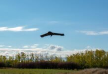
In a preliminary trial in late 2017, Vodafone used its 4G network to control a 1.3-meter-wingspan, 2-kilogram X-UAV drone. Throughout the preliminary trial – which took place over a 32-kilometer course around the town of Isla Mayor, near Sevilla in Spain – the drone transmitted a real-time HD video feed and flight data, including speed, RPS location and GPS coordinates.
Further trials, which will be coordinated with the relevant authorities, are now scheduled in Spain and Germany through 2018 with the intention of making the Vodafone drone tracking and safety technology available for commercial use starting in 2024.
Vodafone says the technology behind RPS will also be used to boost the functionality of other IoT devices in future – from luggage tags to bicycles. RPS could support, or replace, GPS in some IoT devices, enabling better location tracking – particularly, indoors – the creation of smaller devices and enhanced security.
“This groundbreaking innovation by Vodafone will help to ensure the skies stay safe as drones become ubiquitous, everywhere,” comments Johan Wibergh, Vodafone Group’s chief technology officer.
According to Vodafone, the trials support the objectives of the European Aviation Safety Agency, with whom Vodafone has collaborated. The new technology also supports the European Commission’s “U-space” vision for innovative and safe drone operations.
Matthew Baldwin, deputy director general of the European Commission, adds, “The commission supports all trials aimed at realizing our U-space vision for safe commercial drone operations in the EU – there is a growing network of demonstrations and projects across the EU. We look forward to hearing the results of Vodafone’s work.”


