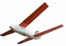
San Diego-based Straight Up Imaging has launched the Endurance unmanned aircraft system (UAS), a multi-rotor drone designed specifically for aerial imaging.
The drone, which was tested in NASA’s wind tunnels, offers a flight time of 25 minutes with each of the three available payload packages:
- The surveyor package has the choice of a Sony QX1 imaging sensor for orthomosaic and elevation mapping or a near-infrared spectroscopy sensor for normalized difference vegetation index crop health assessment. The mission-management technology automatically geo-references each image for processing by most open-source or commercially available mapping software.
- The imaging package provides aerial photography and videography with a GoPro Hero 4 Black camera mounted to a three-axis stabilized gimbal. A combination of mission planning and software processing produces photorealistic three-dimensional scans of buildings and structures.
- The first-responder package combines a FLIR Vue Pro thermal sensor on a three-axis gimbal with a full-motion video downlink – providing real-time and recorded infrared imagery by day or night. The package is designed to assist fire services, paramedics, police officers and emergency medical technicians but can also be used for security, infrastructure inspections and wildlife monitoring, says the company.
According to Straight Up Imaging, the Endurance system is presented as a turnkey solution, which includes the vehicle, three flight batteries, a radio transmitter and tablet, a dual-battery charger, an operations/maintenance handbook, a telemetry system, and a transport/storage case.


