DroneDeploy, DJI Partner on Construction Mapping Solution
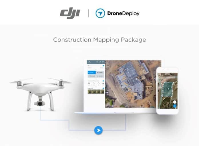

San Francisco-based DroneDeploy, which provides a cloud software platform for commercial drone users, says it has joined together with drone technology giant DJI to bring an all-in-one unmanned aerial vehicle (UAV) system to construction enterprises.
Available now from DJI’s online store, the DroneDeploy & DJI Construction Mapping Package includes a one-year Pro or Business software subscription to the DroneDeploy platform, the DJI Phantom 4 Pro drone and other drone accessories.
“DJI Phantom series drones have set the standard for businesses that need an easy and affordable way to capture detailed aerial data from their sites,” says Jan Gasparic, head of enterprise marketing. “DroneDeploy has built a powerful platform for taking data from DJI’s aerial platforms and turning them into actionable data for businesses. By bringing these two platforms together as the Construction Mapping Package, the construction industry has a turnkey mapping solution to introduce or scale out their drone operations.”
With DroneDeploy’s platform and third-party tools and integrations available for install within the DroneDeploy interface, project managers and visual design coordinators are able to deploy drones to do the following:
- Generate accurate site surveys with ground control points in a fraction of the time required with traditional survey methods;
- Efficiently collect aerial data to improve quality control, manage assets and reduce risk on the job site;
- Quickly create weekly drone maps of job sites to track progress and instantly share data between teams on desktop and mobile devices;
- Make smarter quality assurance decisions by combining building information models (BIM) with high-resolution point clouds of actual site conditions; and
- Directly integrate drone maps and point clouds with Autodesk, Procore, Box and other industry-standard software.
DroneDeploy says its software allows for intuitive automated flight so workers can fly the site, then view and analyze high-resolution maps and 3D models within the same day. Team members can then share the data and analysis with others for improved communication. They also have the capability to bring maps into the field on mobile devices to improve on-site inspections with annotated notes, photos and measurements.
“Many leading construction enterprises use our extensible software platform and drone data analysis tools to save time and reduce risk on job sites with sharable drone maps and 3D models,” says Mike Winn, co-founder and CEO of DroneDeploy. “This partnership with DJI paves the way for greater drone adoption across the construction industry.”
General contractor Brasfield & Gorrie LLC is currently leveraging DJI drones powered by the DroneDeploy platform to monitor site progress, communicate with key stakeholders and increase return on investment with the use of drone-generated 3D models.
“Using DroneDeploy, we’ve generated point clouds so detailed they’ve been mistaken for video,” says Hunter Cole, virtual design coordinator at Brasfield & Gorrie. “But unlike a video, I can get the volume of any material stockpile on that site; I can make any linear measurement; and I can overlay the drone-generated point cloud over 3D BIM model, line it up exactly and see very quickly what’s been built versus the design intent.”