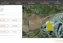
Delair Offers ‘Unlimited’ Cloud-based Drone Photogrammetry Plan
Delair, a provider of visual data management solutions for enterprises, has announced its "unlimited photogrammetry plan," available through its cloud-based delair.ai visual...
Florida-based UAS Team Documents Dorian Damage in the Bahamas
An unmanned aircraft systems (UAS) team recently surveyed damage in the Bahamas in the aftermath of Hurricane Dorian, providing situational awareness to...
Pix4D Opens New Denver Office
Drone software company Pix4D has opened up a new office in downtown Denver, representing the company's seventh location globally.
SimActive Software Used for Gold Mining Projects
Drone photogrammetry software company SimActive Inc. has announced that its Correlator3D is being used for gold mining projects in the Ivory Coast...
USDA Funds UAV Projects for Natural Resource Conservation
The U.S. Department of Agriculture’s (USDA) Natural Resources Conservation Service (NRCS) recently announced funding for projects using unmanned aerial vehicle (UAV) technology.
NUAIR Teams with Indian Nation on UAS-Based Environmental Protection Program
The Oneida Indian Nation, a federally recognized Indian nation in central New York, has formed a new partnership with Northeast UAS Airspace...
Aeromapper Talon Drones Fly BVLOS Missions Over Marine Reserve
Two "amphibian" Aeromapper Talon drones were recently used during a set of trials for an expedition to Turneffe Atoll in Belize as...
Woolpert Approved by PennDOT to Fly Drones for State Projects
Woolpert had numerous surveying, mapping and geospatial professionals complete the Pennsylvania Department of Transportation’s (PennDOT) unmanned aircraft system (UAS) training on July...
Weaver Finds Success with Delair UAV for Landfill Mapping
Weaver Consultants Group, an environmental services company based out of Chicago, has adopted Delair's UX11 unmanned aerial vehicle (UAV) for large-scale volumetric...
Microdrones Providing UAV Solutions for Critical Incident Management
Unmanned aerial vehicle (UAVs) solutions provider Microdrones is partnering with Critical Scene Incident (CSI) Mapping, which supplies law enforcement with professional forensic...


