Last Thursday night, a drone operator in Mountain View, Calif., reportedly crashed his aircraft into a high-voltage wire and subsequently cut the power for 1,600 residents for a few hours, the city claims.
According to an update from the City of Mountain View, witnesses told police officers that a man had been flying (and crashed) a drone in the area of Polaris Ave. before the Pacific Gas and Electric Co. customers lost power from about 8:15 p.m. to 11 p.m. Affected areas included the city hall and library.
The city, which is still looking to identify the drone operator, says the damage cost “tens of thousands of dollars.”
On Facebook, the Mountain View Fire Department offers a picture of an unidentified, charred object: 
The fire department also says in a comment, “FAA regulations state specifically that drones cannot be flown around people and must remain clear of surrounding obstacles – the power lines would be just that. And given that this was a residential area, that’s two issues that caused concern on our part in terms of public safety. We do not know at this point if the operator of the drone notified officials that they planned to fly it last night.”
Notably, according to the city’s update, the area was also reportedly within a five-mile radius of an airport. Indeed, the Know Before You Fly airspace map, powered by AirMap, shows that the area of Polaris Ave. is within that radius:
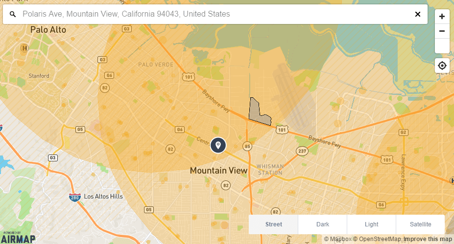








If you look at the AirMap photo in the article they say the area is “RESTRICTED”.
As a drone operator it looks like the person only need to notify two airports and one heliport.
I do not see the area restricted as per the article.