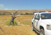
Yesterday morning, the Plumas National Forest, located in the Sierra Nevada in northern California, flew an unmanned aerial vehicle (UAV) over the Minerva Fire.
According to the U.S. Forest Service, the drone was equipped with a FLIR infrared camera, which detected heat and produced thermal imagery so that the fire managers would be able to get an accurate assessment of remaining heat pockets. In addition to the thermal imagery, the drone was also used to produce an updated map of the fire.
Before the flight, the Forest Service noted that residents who might see the UAV should not be concerned: Although recreational drones are prohibited in the area of the fire, the drone used for this mission was an authorized firefighting tool providing valuable information.
According to a Facebook update from the Plumas National Forest, the crew had planned to fly both multi-rotor and fixed-wing UAVs, but due to weather conditions, they flew only the 3DR Solo drone.
Photo courtesy of Leslie Edlund/the Plumas National Forest’s Facebook page


