In December 2016, Amazon executed its first customer delivery by drone outside of Cambridge, the U.K., and more recently, the e-commerce giant’s patent was published for a “multi-layered fulfillment center” that would allow its drones to better and more rapidly serve customers in urban areas.
But as Amazon (Prime Air), Google (Project Wing) and others aim for widespread deployment of drones for the delivery of goods to consumers and businesses, it is increasingly clear that advanced weather data will play a critical role in ensuring these drones can fly their weather-sensitive missions safely and efficiently.
Weather is just one of several challenges that commercial drones will face. The sheer volume of drones – paired with naturally flying objects such as birds – will, of course, require advanced navigation systems and a tremendous amount of coordination. (The FAA estimates the fleet of commercial drones could grow from 42,000 in 2016 to 1.6 million in 2021.)
Even with those obstacles yet to be ironed out, the need for more advanced weather data will, in many ways, dictate the speed and breadth of commercial drone deployment. The following are key challenges impacting the three phases of commercial drone operations, as well as how advanced weather data can be leveraged to make the promise of drone delivery a reality for consumers and businesses.
Phase 1: Pre-flight planning
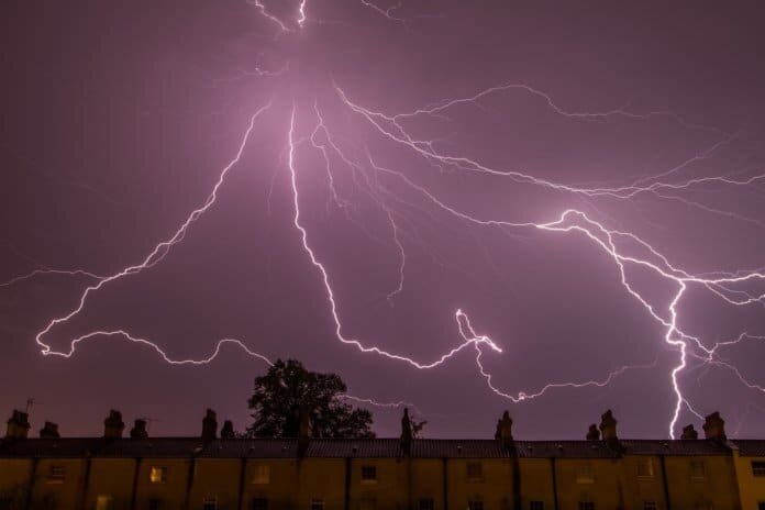
Drone operations require us to forecast weather with hyper-local precision to determine where it will be clear, rainy or snowy – or, of greater relevance, where severe weather is occurring – so that the aircraft can be routed around lightning or grounded until weather clears.
Advanced weather data can transform the efficiency and safety of drone operations used for delivery of goods and other commercial applications. In addition, businesses in oil and gas, construction, government, energy, and other weather-sensitive industries can leverage advanced weather data analytics for safe site surveying, better response to disasters and emergencies, and protection for their significant investments in drone assets.
This data can also be vital for safeguarding business assets from severe weather. For example, energy companies build outage models using real-time hourly forecasting for every point in the country. These companies can then plan field teams accordingly and also plan drone operations to be conducted after a weather event to assess infrastructure damage that may have occurred. By storing site surveys and historical weather data, companies can gain insight into how weather patterns are affecting their projects and critical assets.
Finally, this data enables businesses to reduce or even eliminate backup days that traditionally must be factored in if primary drone flight days are derailed by bad weather. The ability to get more granular about specific mission planning days in advance through hourly forecasts allows businesses to pinpoint specific days – or even hours – when drone flights will yield the best results for data collection.
Phase 2: In-flight operations
Weather data impacts path direction, flight elevation, mission duration and other in-flight variables. Wind speeds in particular are a critical component to deploying smooth drone-based missions and thus should be factored in the project planning and deployment phases. Ground-based wind sensing can be used as a proxy to boundary-layer wind measurement, but there is a need for low-altitude wind speed data, as well.
Most drones used will operate in a low-altitude range of 10-400 feet – which means drones fly too high for surface-level wind data to be used exclusively and too low to rely on wind data used by airlines operating at much higher altitudes. We are starting to see the rollout of low-altitude wind products to address this 10-400 feet gap, where it has been historically challenging to gather wind data.
At the same time, safe and efficient drone flights require an understanding on how long drones can fly based on battery life. Real-time access to both temperature (which impacts battery life) and wind data (routing a drone to fly with the wind rather than against it can extend length of mission) is key.
And, as important as weather data is to drone missions, the quality of imagery that drones can capture on missions also depends on efficient flight operations. If there is significant wind or rain, the drone doesn’t operate effectively, and the captured imagery may be unusable. With this approach, the additional time drone operators must take into account for drones being knocked off course thanks to weather is reduced – translating to shorter missions and lower costs.
Phase 3: Post-flight analysis
Data collected from drone missions paired with weather data can help users understand how weather may have impacted sites over time. Infrastructure inspections are just one example that comes to mind here: Annual bridge inspections can overlay historical weather data to understand the impact of weather on the health of the bridge’s infrastructure from year to year – including if severe weather, including lightning, may have struck the bridge.
Over time, advanced weather data will not only guide commercial drone navigation, but some drones themselves will, in effect, become tiny, microscopic sensors that can fly in swarms by the tens of thousands. At any moment in time, these sensors could fly through regions to detect hyper-local, micro-accurate weather patterns down to the minute. As an extension of the growing Internet of Things ecosystem of devices and sensors, these lightweight drones will connect to a host of weather data sources – and other data sources, as well – to transform weather forecasting as we know it today.
By analyzing data through advanced weather visualization dashboards, you can improve your drone flight operations to ensure future mission success.
Mark Hoekzema is chief meteorologist and director of meteorological operations at Earth Networks.


