AeroVironment Inc., a provider of unmanned aircraft systems (UAS) for both military and commercial applications, is sharing the details on its ongoing pilot programs with farmers and universities.
The programs, which are entering their third year, have guided the development of the company’s trademarked AV Decision Support System (DSS) platform.
“Our extensive work with early-adopter agriculture customers continues to inform the architecture for our Quantix drone and AeroVironment Decision Support System,” says Jon Self, vice president of commercial information solutions at AeroVironment. “The pilot programs allow us to learn how to integrate drone technology into the way growers operate and is helping us to develop some very specific analytics.”
AeroVironment partnered with a group of independent farmers and universities to test the Quantix drone and AV DSS platform for commercial farmers and operators.
The project team has surveyed tens of thousands of acres during the past two years. They’re focusing the research efforts on crops such as almonds, walnuts, corn, grapes, sugar beets, strawberries and tomatoes to test analytics for the identification of canopy cover, early-disease detection and yield-prediction capabilities.
The projects employed a variety of sensors, including photogrammetry, multispectral and LiDAR, to develop highly precise (1-inch resolution) topographical maps for water management: specifically, flow diagrams examined drainage, erosion, run-off and tile line designs within a field.
As the pilot programs extend into 2017, AeroVironment plans to expand research to include additional surveys of row crops, specialty crops and permanent crops. The research will help ensure that Quantix with AV DSS will continue to evolve in its precision and targeted crop analytics, the company says.
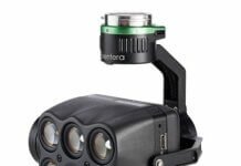
The recently introduced Quantix drone features a hybrid design that combines the aerodynamic efficiency of a fixed-wing aircraft with the flexibility of a multi-rotor drone. The aircraft is designed to pair with AV DSS in order to allow growers to easily review drone-collected data.
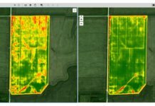
Quantix collects RGB and NDVI multispectral images that can be viewed on-site immediately after each flight. They are then uploaded, processed and stored securely in the cloud for growers to view on their mobile device or a desktop computer. The platform is also equipped with an alert system that notifies farmers of anomalies in the field.
The company recently announced a yearlong study with California State University, Fresno to research how UAS imagery and analytics could potentially detect varying levels of water stress in almond trees and give producers smarter insights to make more effective in-season decisions regarding water management.
AeroVironment also has engaged with North Dakota State University on a similar study to enable the early detection of three key diseases in sugar beets. According to the company, findings could help sugar beet growers identify infected plants before symptoms are visible to the naked eye.
Quantix and AV DSS will be available for sale later this year, notes AeroVironment.


