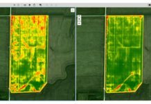
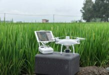
Springfield, Ohio-based Clark State Community College has begun flying unmanned aircraft systems (UAS) as part of its new precision agriculture program.
The program is designed to prepare students for employment with companies using geospatial technologies, including geographic information systems and global positioning systems applied to agricultural production or management activities, such as pest scouting, site-specific pesticide application, yield mapping or variable-rate irrigation.
“Precision agriculture is expected to be among the largest uses of UAS technologies, and Clark State is now preparing its students for employment in this emerging industry,” says Dr. Jo Alice Blondin, president of Clark State.
The initial flight operations were conducted in Springfield over designated farm fields with an EH-4 small quadcopter flying below 400 feet. The EH-4 was developed by SelectTech Geospatial, also based in Springfield.
The Federal Aviation Administration (FAA) approved the Certificate of Waiver or Authorization (COA) for the Ohio/Indiana Unmanned Aerial Systems Center (UASC) earlier this year.
The center is working to expand the number of FAA-approved COAs for research across Ohio and currently operates 11 COAs in support of public entities and universities (including Clark State), with an additional 17 COAs pending at the FAA.
The OH/IN UAS Center is a joint venture between the states of Ohio and Indiana. The overall mission of the UAS Center is to advance UAS commercialization and support flight operations for government and agencies.


