Monthly Construction Progress Capture: Flight Plan, Deliverable and What to Charge
Monthly drone site-surveillance work is priced and pitching as a recurring retainer, not on an ad-hoc photo-visit. Expect to bid in the $1,200–$8,000 range per construction site, depending on the site size, job complexity,visit frequency and deliverable depth. This article explains the pricing bands, the service deliverables, the reporting framework, and the key marketing message.
Monthly Retainer Math
The economic baseline of recurrent drone monitoring is that monthly work bills cheaper than ad-hoc flights. The rates are set at $1,200–$3,000 per site per month on average, down from a $1,500–$4,000 market range for a single site book. For larger or more regular monitoring, there is an $2,000–$8,000 range for a four-visit, roughly monthly schedule. The 15%–25% subscription discount versus one-off rate-card driving the pricing package.
On a per-visit basis, commercial drone progress monitoring lands at $250–$600 per camera visit, landing at a $1,500–$3,500 monthly recurring billing for two photographs and at $3,000–$5,000 for four visits plus the full suite of deliverables.
Pricing varies by vendor, but the stacked vendor-scale economics of regular drone work means that even at the lower $1,500 per-month end of the market, a site operator can expect a significant portion of the work to be a repeatable, packageable cycle rather than a series of one-off deployments.
What Gets Delivered to the GC
Drone-camera dissatisfaction with a contractor often arises from an under-specified service offering. Under-promise and over-deliver: most regular construction progress monitoring packages include a range of outputs in addition to standard site photos:
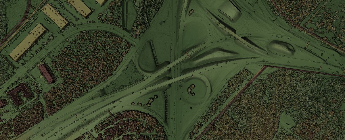
- Orthomosaic map: a high-resolution orthogonal image with a GIS overlay
- 3D model: a 3D model that approximates the site surface
- DSM: a Digital Surface Model as a differential from the 3D model
- 3D point cloud: a GIS overlay that layers the 3D coordinates at autorecognized key points
- Annotated oblique stills: overhead photos with key site indicators and position markers
- Cut/fill volume report: a report of earth removed/offloaded relative to an initial or prior survey
This is not the occasional camera visit some GSTs pitch, but consistent survey and reporting template.
As a monthly evens out variable usage and price for the GC, some recurring flying packages is priced to include a zoomable comparison slider between recent captures, an annotated safety report, and an MPEG walk-through video of the site from the drone perspective.
None of this includes the GCP, geolocation, or metadata elements a larger GC may want, but sets baseline contract requirements for the photographed product and any owner adding their own specifications.
How the Monthly Report is Structured
One of the reasons that drone progress monitoring can provide a discounted package is that every periodic capture gets baked into a standardized surveillance-report template, which keeps flying intervals regular and the administrative details repeatable.
No generic brochure here: of the monthly-reporting templates observed, one observed template called out the following for a first-day page
- Executive summary
- Progress against program
- Safety/access observations
- Raw data archive location
The balance of the document gets built on a chronologically-stamped image-report log listing in sequence the
- Photographic sequence
- Key landmark/service in image
- Capture date/time
- Filename/archive code
The cover page lists
- Project name
- Client
- Main contractor
- Reporting period
- Report number
- Survey date [, should that be capture date ]
- Coordinate system
- UAS operator
Lastly, this template contained sign-off by and by the client representative, and documented the raw data archive location where any of the still images or 3D geographic overlays could be pulled down. Pricing the team's drone work as a monthly package means the data and communications need to be structured that way. On repeatable capture timing.
Storage, Sharing, and Traceability
A recurring value promise that outweighs capturing more stills than the GC can view internally or collate with the rest of the project documentation is importing those images and overlays into a regularly-updated GIS archive along with a formatted data-and-signature block the QC team can use.
The details above — chronological listing of images, client sign-off, filename/coordinate/plum/date flushouts cross-referenced in both the export and the raw-data hive(sic) to endless on-digital pipeline — may not be real-time logistics, but they are a monthly rotation;
Laying in these upstream additions makes construction progress monitoring not just a line-item photo export but the survey and report architecture the GC expects for full lifecycle reporting.
Packaging the Recurring Job
While work on construction sites gets paid on a weekly progress basis, not on a realized surcharge, the incorporated progress reporting does show the.
Regular construction work builds monthly from two main elements: the captured photo/video product and the downstream GIS overlays that
That may not raise the bar on the content, but it gets the scope settled.
What Not to Claim
Monthly construction drone reporting adds a lot of analytics and reporting to a regular run of visuals, but it does not have a national scope or certification.
Avoid claiming common terms like "just cameras" or "engineering spec delivery". Drone imagery is part of a site-monitoring surveys and receiving data-slides not linking the planning databases - not an arcane GCPE job nor a dispassionate property survey.
A good recurring contract gets the GC 360-degree coverage aimed at billing month to month. It usually does not include contractor signing or tenant housing inspections.
A monthly drone-reporting package does get the work in the field, on schedule, available in the clearinghouse — but it does not call it a certification.
Capturing construction progress monthly gets you a stack of site photos, a set of GIS coordinate overlays, a chronological satellite survey, and a reporting platform with a timely project-comparison slider, but it does not have a national standard for pricing, structure, or service. Watch any numbers that span demand, delivery, pricing, or audit by Geographic Zone — best to talk in market bands or common goals, and not to claim regional or technology-driven details as rules.
A recurring construction photo report is not inspection nor final fit. It is progress documentation. The ratios may not match each internal procurement book.
At a rough average, construction drone documentation lands between $1,200 and $8,000 per site per month, depending on site size, ongoing requirements, and deliverable complexity, but the traded deliverables remain a set of stills, continuous video, overlay imagery, 3D models, and structural reports on a security-approved series of databases
Really, signing up for regular construction reports means regular reportable stacks of field reports and data overlays — it does not meet the requirements for official inspection or specified-building progress.