LiDAR or Photogrammetry: Choosing the Payload From the Deliverable Backwards
When planning a drone mapping survey, drone operators commonly need to choose the right payload to match the client's deliverable needs. This decision has nothing to do with the latest marketing claims - it comes down to a simple question.
What does the client's contract actually require?
Deliverables first, sensor second
Surveys serve client deliverables, not sensor manufacturers - so there is no sense in talking about LiDAR or photogrammetry before knowing what the client needs.
Drone mapping delivers industry-standard products like orthomosaics, digital elevation models, 3D meshes, contour lines, and point clouds [REF][8][REF. A project might need only an orthomosaic and a digital surface model to see the vegetation and buildings exactly as they appear. In other cases, the output has to be a classified point cloud in LAS/LAZ format so that software can analyze ground cover and building heights [REF][1][REF][2][REF][9][REF. When a digital terrain model is required, that eliminates all deliverables except the DTM.
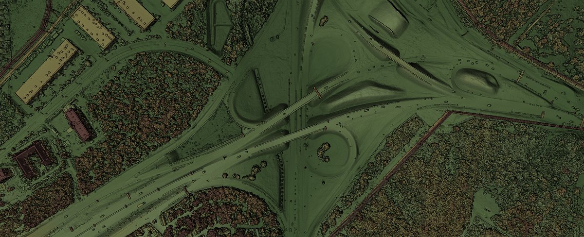
A LiDAR survey can deliver all of these, but LiDAR has a special advantage in areas where vegetation obscures the terrain. A LiDAR point cloud penetrates the vegetation and more accurately represents the actual ground, not just what is visible on the surface [REF][1][REF][3][REF.[7][REF.
What accounts for that change are the physics of the deliveries LiDAR and photogrammetry show.
Where vegetation changes the answer
While both drone mapping sensors deliver orthomosaics, point clouds and DEMs and DTMs, they deliver differently.
LiDAR's technology sends out its own light to measure terrain and elevation, while photogrammetry works from positioning a camera. That means a photogrammetric point or mesh only shows what is visible to the camera for its reference shots. In dense vegetation, it can't look through the canopy. Indeed, its accuracy decreases as vegetation height rises.
In one study, photogrammetric accuracy decreased by 0.10 m for every 20 cm of vegetation height [REF][4][REF. A 2020 paper says the algorithms were originally developed for LiDAR data and assume LiDAR pulses can penetrate through gaps in vegetation canopies, so estimation is better for LiDAR than for photogrammetry [REF][5][REF][6][REF.
So it's not about elevation as such, it's about vegetation and ground visibility in the predictable soil spots.
What the work product actually costs
So while Precision concerns about accuracy and penetration are real, they can be wrapped up directly in a predictable set of true costs to the drone operator of the practice.
For photogrammetry, a 5–10 ha survey with an orthomosaic, point cloud and DEM runs AUD 1,800–4,000 on average; day rates for photogrammetry run AUD 1,500–2,500 per day. Terrestrial LiDAR day rates run AUD 1,800–3,500 [REF][10][REF. One quote says LiDAR pricing runs about 2 to 3 times photogrammetry [REF][12][REF.
That's a rough set of numbers without context. But the operational rule is that LiDAR needs to pay for itself, so its time on the job needs to recoup it. That adds a well-documented premium to each operation.
The terrain-versus-surface distinction
Contract deliverables rule out sensor choice in 3D terrain mapping. For example, agricultural drone mapping to recruit farmer clients needs to present terrain, in both 2D ortho-mosaic form and in a digital terrain model [REF][1][REF. It's not just a pricey sensor purchase. It's also a substantial post-processing labor cost, recognizing that drilling down from an orthomosaic and a DSM to a DTM manual classification is a time-consuming, skilled process.
A terrestrial study confirms that LiDAR delivers you these terrain values better in human-manipulated, vegetation-rich landscapes than photogrammetry can [REF][7][REF.
And as always, photogrammetry can produce a DSM that represents the surface of the vegetation but not the terrain underneath. So it can be half the price but also half the deliverable.
Buy the sensor the contract requires, not the one being marketed
When the client needs a DSM, terrain model or classified point cloud - especially in a vegetation-rich environment, buy the LiDAR.
When the client needs a light orthomosaic and a DSM, buy the photogrammetry set up, and be confident that your customer's time was spent efficiently. There's no need to break the bank accounting for hits to classified-rated precision in dense foliage.
To put it another way, the annual revenue of the drone-geospatial business, which hit [REF][15][REF, is not about LiDAR or photogrammetry, street maps beyond your capability, but about knowing what the commissioned work is, and matching sensors there.