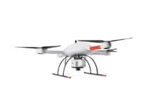
Georgia-based Hexagon Geospatial has officially launched GeoApp.UAS, an app that enables automated processing of unmanned aerial systems (UAS) data on the cloud.
Developed by Hexagon Geospatial’s partner, GEOSYSTEMS GmbH, GeoApp.UAS is an end-to-end solution that allows users to upload UAS data into M.App Chest, Hexagon’s cloud-based hosting environment. Hexagon says that with an intuitive workflow, GeoApp.UAS enables photogrammetric processing of UAS data, creating value-added content like image mosaics and 3-D point clouds from the raw images.
“Although UAS use has skyrocketed, the photogrammetric processing of associated data has remained highly intensive and requires expensive, complex and stationary desktop software environments,” says Mladen Stojic, president of Hexagon Geospatial. “GeoApp.UAS is transforming the way organizations can rapidly process this data using the computational power of the cloud.”
In September, Hexagon Geospatial announced the introduction of the GeoApp.UAS early access program, which provided users the opportunity to test out the streamlined UAS data processing workflow.


