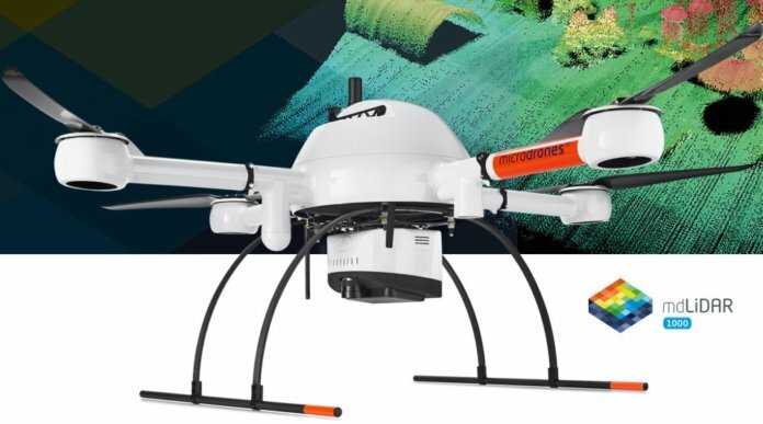
On Sunday, on behalf of Edmonton International Airport (EIA) in Alberta, AERIUM Analytics flew a Microdrones mdLiDAR1000 to collect LiDAR and imagery data of the airport’s runways.
The data will be used to more accurately predict when EIA should conduct preventative maintenance on runways, taxiways and aircraft-handling aprons. The drone operation was approved by Edmonton Airports in collaboration with NAV CANADA, which owns and operates the country’s civil air navigation system.
Microdrones has developed an end-to-end LiDAR solution combining a drone, a LiDAR payload, a fully integrated software workflow and global support. The mdLiDAR1000 is a fully integrated system for producing 3D point clouds, optimized for land surveying, construction, oil and gas, and mining applications.
Steve Maybee, EIA’s vice president of operations and infrastructure, says, “Thanks to the hard work of our operations team and our partners in Nav Canada and AERIUM Analytics, our airport is a leader in this field [of drone technology], and we are fast approaching the point where drones are just part of the regular flight operations at EIA.”
EIA has 2 million square feet of runways, taxiways and aircraft-handling aprons to maintain. This is the fourth year that AERIUM Analytics has operated drones at EIA, beginning with Robird robotic falcon flights to control bird activity. So far, AERIUM has conducted well over 3,000 airport flights.


