SimActive Inc., a Montreal-based developer of photogrammetry software, says Israel-based Airobotics has chosen SimActive’s Correlator3D for its drone platforms.
SimActive says the software will be used to derive mapping products for the needs of industries such as energy, mining, and oil and gas.
Airobotics provides an end-to-end, fully automatic solution for collecting aerial data and gaining insights at industrial facilities. Earlier this year, the company secured $28.5 million in combined A and B rounds from U.S. investors.
“SimActive is joining our growing software and hardware ecosystem of partners, and we are confident that this partnership will not only showcase the endless potential for the future of photogrammetry aerial data and automated drone solutions but also set the standard as to how industrial facilities can utilize UAVs for aerial mapping and data,” says Ran Krauss, co-founder and CEO of Airobotics.
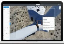
SimActive’s Correlator3D software is a patented photogrammetry solution for the generation of geospatial data from satellite and aerial imagery, including unmanned aerial vehicles. The software performs aerial triangulation and produces dense digital surface models, digital terrain models, point clouds, orthomosaics and vectorized 3D features.
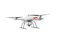
Philippe Simard, president of SimActive, adds, “Clients with wide-ranging requirements – including inspection, surveying, mapping, security and emergency response – will benefit from the Airobotics drone system, integrated with SimActive’s Correlator3D.”
Photo courtesy of SimActive


