Image

Skyward and PrecisionHawk Come Together for Full-Service Drone Platform

PrecisionHawk, a terrestrial data acquisition and analysis company, and Skyward, a provider of an operations management platform for commercial drones, have come together to provide what they say is a full-service drone platform for commercial customers.

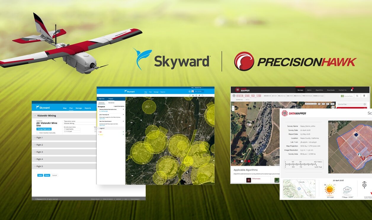
According to a joint press release from the companies, the partnership will offer a complete package of technology tools to increase efficiency across the commercial drone market: i.e., a one-stop shop for customers to plan, map, manage and analyze their assets using a drone platform.

“Drone operators need resources to efficiently manage fleets and get accurate airspace intelligence,” comments Jonathan Evans, CEO of Skyward. “This partnership builds on the robustness of the existing PrecisionHawk platform.”

The partnership includes three components:

1) The integration of Skyward’s flight operations system with the Lancaster drone, the DJI-PH Smarter Farming package and Precisionhawk’s DataMapper;
2) The integration of Skyward’s airspace intelligence tools with PrecisionHawk’s LATAS safety platform; and
3) Access to an end-to-end commercial platform – from planning to aerial data collection to analysis.

“This partnership with Skyward allows us to provide a complete commercial drone offering to the market,” adds Christopher Dean, co-founder and president of PrecisionHawk. “We are excited to partner with Skyward and bring this holistic offering to our customer base.”

Teams Compete in Drone Search-and-Rescue Challenge in N.Y. This Weekend

Posted 08/24/16 by Betsy Lillian and filed under:

DJI is joining Ford Motor Co. and the United Nations Development Programme (UNDP) on Sunday to host its annual SDK Challenge, which is taking place at the Federal Aviation Administration-designated drone test site at Griffiss International Airport in Rome, N.Y.

Ten teams will compete for a $100,000 prize to see whose software can best launch drones from the bed of a moving vehicle, guide them through a simulated disaster site to identify victims and return to land back on the vehicle.

The 10 finalists from universities and research groups around the world have built their solutions with DJI’s software development kit (SDK).

Guests will have the opportunity to fly DJI drones, as well as observe the competition in progress. Media will be able to interview contestants and officials from DJI, Ford and the UNDP.

The competition will take place at 9:15 a.m. to 4:00 p.m., and the awards ceremony will take place at 6:00 p.m.

More information about the DJI SDK Challenge can be found here.

AMA Crowns Winners of UAS4STEM National Competition

Posted 08/24/16 by Betsy Lillian and filed under:

On Saturday, Aug. 20, middle and high school students from across the U.S. competed in the UAS4STEM program’s first national competition, held at the International Aeromodeling Center in Muncie, Ind.

The teams built their own drones and competed in various flying challenges for the national title. According to the Academy of Model Aeronautics (AMA), the organizer of UAS4STEM, the contest is designed to teach science, technology, engineering and math (STEM) skills.

The 2016 UAS4STEM Search and Rescue Challenge’s first-place winner was Quad Squad from Shoreview, Minn. They were awarded a trophy, medals and a $2,500 cash prize.

The PTC Droners of Georgia took second place, and the St. Mary’s CAP Squadron-O89 of Maryland took third place.

The Dewey O. Broberg Jr. scholarship was also awarded to one of the competitors during the competition. The award recognized a team member, Paige Hensley, who showed dedication, determination and adherence to the rules and purpose of the competition, says AMA.

UAS4STEM was designed by AMA to encourage teamwork, competition and success through a STEM-based education platform. The program provides student teams of four to eight people with training, insurance, licensing and equipment to compete in search-and-rescue challenges. The program is managed by AMA’s education department as part of AMA Flight School. Each of the teams that participated in the national competition earned its spot by qualifying at one of the many regional competitions held throughout the country.

3DR Wins Federal Contract for Up to 40 Drones

The U.S. Department of the Interior (DOI) has awarded a contract to Berkeley, Calif.-based drone company 3D Robotics (3DR) for up to 40 small unmanned aircraft systems (UAS), which the department says will be used for myriad applications.

According to Mark Bathrick, director of the department’s office of aviation services, the aircraft will be used for missions such as “wildlife and vegetation surveys, fire management, search and rescue, hydrologic study, cultural resource inventory, and surface mining monitoring.”

“These UAS will not only provide us with better science and reduce the risk to our employees, but they will result in cost savings and better service for the department and the American people,” Bathrick says.

The DOI says the award follows a lengthy process to develop performance requirements and select the most useful type of aircraft. 3DR’s 3.3-lb. drones, according to the DOI, are capable of carrying a variety of sensors and will be easily customized for the types of fieldwork and emergency-response operations performed by the department.

In addition, the DOI says the size and weight of the small UAS provide operators a simple, efficient and inexpensive tool to collect aerial data; their design allows for rapid deployment of new payload options as new sensors become available, the department explains.

“The contract is extremely important to the department, as it will allow us to conduct many missions that were previously impossible due to limited resources and costs associated with using manned aircraft,” states Harry Humbert, deputy assistant secretary for public safety, resource protection and emergency services.

Photo courtesy of the DOI

Drones Brought in to Keep Churches in Tip-Top Shape

Posted 08/23/16 by Betsy Lillian and filed under:

London’s National Churches Trust – a charity dedicated to promoting and supporting church buildings of historic, architectural and community value across the U.K. – has received 90,100 British pounds from the Heritage Lottery Fund for the Yorkshire Maintenance Project, which will involve using drones to help keep churches and chapels in Yorkshire, Northern England, in good condition and prevent the need for expensive repairs.

Key parts of the project will include unmanned surveys of churches; training workshops to help volunteers maintain church buildings; and “Maintenance Booker,” a new website allowing churches of all denominations to book gutter clearances and other urgent maintenance tasks.

According to the National Churches Trust, the Yorkshire Maintenance Project will help to sustain the rich religious built heritage of Yorkshire. There are 1,095 listed places of worship in Yorkshire; this total includes 346 Grade I churches, buildings of the highest heritage significance, says the charity.

However, according to the group, maintenance of these buildings is often neglected.

The National Churches trust says the drone surveys will provide information and evidence for management and maintenance plans, quinquennial inspections and immediate repair needs. Disks with images will be given to each church to share with its architect. The unmanned inspections will be carried out by the Museum of London Archaeology.

“Regular maintenance is essential for churches,” explains Michael Murray, director of church support at the National Churches Trust. “Something as simple as keeping drains and gutters clear so that water is taken away from the building efficiently is the most important thing a church can do to stop small problems developing into unnecessary crises. An overflowing gutter soon soaks the wall beneath, rots the roof timbers behind it and makes the whole building vulnerable. As well as keeping a church building in good repair, preventative maintenance saves money as it has been estimated that every 1 British pounds spent on keeping a church in good condition saves 30 British pounds in repair costs within five years.”

Connecticut DOT Keeps Its Eyes on UAVs for Bridge Inspections

Posted 08/23/16 by Betsy Lillian and filed under:

The Connecticut Department of Transportation (CTDOT) says it is deploying unmanned aerial vehicles (UAVs) as part of its ongoing mission to improve and evaluate its operations and assess the usefulness and functionality of new technologies.

According to a CTDOT press release from last week, a UAV inspection was scheduled to take place today on the Gold Star Memorial Bridge.

The testing is gauging the ability of the UAV to provide access to and photograph areas of the bridges that are typically difficult to reach via traditional means, such as snooper trucks or ropes and climbers.

The Gold Star Memorial Bridge consists of two distinct structures carrying I-95 northbound and southbound, respectively, over the Thames River between Groton and New London. According to the CTDOT, the structures – at roughly one mile each – are the longest bridges in the state and have main spans rising approximately 100 feet over the Thames River.

Last October, the CTDOT completed a full routine inspection of the Gold Star Memorial Bridge using lifts, snooper trucks, and ropes and climbers.

Upon completion of this new test inspection, the CTDOT will perform an analysis of the results, including the advantages and disadvantages of the system and its effectiveness at gathering detailed information in comparison to previous methods.

“This is an important step for our agency – the testing of a new technology with the potential to improve results, efficiencies and safety for the public,” says Commissioner James P. Redeker. “The willingness to examine new technologies – to innovate and to keep an open mind – is critical if we are to find better ways of doing business, and I applaud the department’s bridge safety division for initiating this test.”

LiDAR Sensor Company Quanergy Grabs $90M Investment

Posted 08/23/16 by Betsy Lillian and filed under:

Sunnyvale, Calif.-headquartered Quanergy Systems Inc., a provider of solid-state LiDAR sensors and smart sensing solutions, has raised $90 million in Series B funding at a valuation well over $1 billion.

Sensata Technologies, Delphi Automotive, Samsung Ventures, Motus Ventures and GP Capital participated in the round. According to Quanergy, its total funds raised have now reached approximately $150 million.

Earlier this year, Quanergy developed the S3-Qi, a miniature, solid-state LiDAR sensor suited for drones, intelligent robotics, security, smart homes and industrial automation.

Quanergy plans to use the new investment to ramp up production of its sensors in order to meet the growing demand for autonomy in vehicles and other systems.

Dr. Louay Eldada, CEO of the company, says, “We are grateful for the strong support from so many investors who share our vision of creating intelligent sensing solutions that permeate through multiple industries – significantly improving safety and efficiency. Our investors will be essential partners in our continued growth.”

Parrot’s Fixed-Wing ‘Disco’ Drone Is Here

Posted 08/23/16 by Betsy Lillian and filed under:

Parrot has rolled out the all-new Disco drone, a fixed-wing, automatic takeoff and landing unmanned aerial vehicle (UAV) that the company says is designed for a “fully immersive flight experience.”

Available starting next month for $1,299, the Parrot Disco comes with a first-person-view headset, Parrot Cockpitglasses, technology that streams footage captured by Disco’s HD frontal camera. In addition, the new, lightweight (1.6 lbs.) Parrot Skycontroller 2 remote control offers a theoretical range of 1.2 miles.

Parrot Skycontroller 2 can also connect to an iOS or Android smartphone or tablet via the new FreeFlight Pro application, providing the pilot with video streaming and a platform to refine the settings of Disco: e.g., geofencing, limitation of the altitude/distance or recording video on the 32 GB memory of the drone.

Parrot Disco is made from expanded polypropylene and reinforced with carbon tubes – making it both lightweight (1.6 lbs.) and robust, the company expalains, adding that the wings are specially engineered to optimize both stability and speed in flight, thanks to an aerodynamic airfoil that reduces trail and improves lift.

The UAV is propelled by a brushless engine with a folding, bi-blades propeller, which enables the aircraft to reach a speed of 50 mph and resist winds of 24 mph. In addition, the battery offers up to 45 minutes of flight time.

Disco also includes an advanced autopilot: the Parrot C.H.U.C.K 
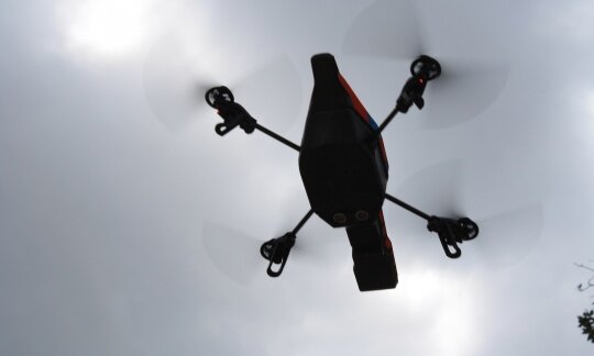
(Control Hub & Universal Computer Kit), which secures each phase of the flight, says Parrot.

To prepare the drone for takeoff, the pilot has to push the switch on the upper part of Disco nose, push the “takeoff/landing” button on the Parrot Skycontroller 2 remote control, and toss the drone toward the sky like a frisbee.

Parrot Disco then takes flight, ascending automatically to an altitude of 164 feet, at which point the drone will fly in a circular pattern until it receives instructions from the pilot.

To land, the pilot must press the “takeoff/landing” button on the remote control. Disco then inclines its flaps and descends below 19 feet in altitude. Following indications from the altimeter, ultrasound sensor and vertical camera, the engine’s thrust reverses to reduce the speed in order to ensure a smooth landing in a straight line, according to Parrot.

The company says Parrot Disco is also compatible with the majority of other remote controls: Model aircraft enthusiasts can connect an RC transmitter (not included) directly to Parrot C.H.U.C.K. The pilot can then perform acrobatics with the drone in full manual mode.

Study: Most UAS Accidents Caused by Technical, Not Operator, Errors

Posted 08/23/16 by Betsy Lillian and filed under:

A new report claims that technical problems, rather than operator errors, have been behind the majority of consumer drone accidents over the last decade.

Researchers Dr. Graham Wild and Dr. Glenn Baxter from Melbourne, Australia-based RMIT University’s School of Engineering, along with John Murray from Perth, Australia-based Edith Cowan University, completed an examination of more than 150 reported civil incidents around the world involving unmanned aircraft systems (UAS).

The study shows that technical problems were the cause of 64% of the incidents, which occurred between 2006 and 2016.

Wild says their findings illustrate the need for further airworthiness requirements for UAS, as well as mandatory reporting of all accidents or incidents.

“Understanding what happens to drones, even those that don’t cause damage to people or property, is essential to improve safety,” he says.

Recently published in the journal Aerospace, the study finds that in most cases, broken communications links between the pilot and the drone were the cause of the incident. The researchers say this finding calls for the introduction of commercial aircraft-type regulations to govern the communications systems.

“Large transport-category aircraft, such as those from a Boeing or Airbus, are required to have triple redundant systems for their communications,” Wild explains.

“But drones don’t, and some of the improvements that have reduced the risks in those aircraft could also be used to improve the safety of drones.”

Wild says more robust communications systems – even on cheaper UAS – could help prevent accidents.

“Drones are being used for a wide range of tasks now, and there are a lot of day-to-day activities that people want to use them for – delivering pizzas and packages, taking photos, geosurveying, firefighting, and search and rescue,” he adds.

“It’s essential that our safety regulations keep up with this rapidly growing industry.”

Insurance Company Announces New Forms, Rules Filings for UAS Coverage

Posted 08/22/16 by Betsy Lillian and filed under:
flying drone

American Association of Insurance Services (AAIS), a not-for-profit national insurance advisory organization, has announced new filings of Unmanned Aircraft Liability Coverage forms and rules in its Agricultural General Liability Program (AgGL) in response to consumer demand for unmanned aircraft systems (UAS) coverage.

AAIS says it also filed a new Personal & Advertising Injury Liability Aircraft Exclusion created to address new liability exposures associated with UAS technology.

The insurance company states that the new AgGL Unmanned Aircraft Coverage endorsements are currently approved in 34 states.

AAIS’ new endorsements were created in anticipation of the Federal Aviation Administration’s (FAA) long-awaited Final sUAS Regulations for small commercial UAS (under 55 pounds). The new regulations were published June 21 and will become effective Aug. 29.

According to AAIS, this ruling is expected to significantly impact the farm and agriculture business, as it is the fastest-growing commercial sector using drones. The soon-to-be-effective sUAS FAA regulations allow farm/agriculture operations to monitor from a maximum of 400 feet.

AAIS will also soon be releasing additional forms and rules for UAS, including the following:

  • A new Farmowners filing of Unmanned Aircraft Liability Coverage forms and rules and new aircraft exclusions under Personal Injury and Personal & Advertising Injury Liability; and
  • Unmanned Aircraft forms for Farm Umbrella (personal and commercial), as well as Agricultural Umbrella Liability coverage forms.

Under the new FAA rules, a person operating a small unmanned aircraft must either hold a remote pilot airman certificate with a small unmanned aircraft rating or be under the direct supervision of a person who does hold a remote pilot certificate. A licensed pilot may obtain a temporary remote pilot certificate immediately upon submission of the application.

UAS Field Day: Hermes 450 Takes to the Sky in North Dakota

Posted 08/22/16 by Betsy Lillian and filed under:
hermes 450

Elbit Systems of America, the Fort Worth, Texas-based subsidiary of Elbit Systems Ltd., says that it hosted an unmanned aircraft systems (UAS) field day today – along with local partners – at the Hillsboro Regional Airport to highlight its recent Hermes 450 flights over North Dakota.

According to Elbit, U.S. Sen. John Hoeven, R-N.D., and U.S. Rep. Kevin Cramer, R-N.D., were in attendance, as well as Lt. Gov. Drew Wrigley, who served as Master of Ceremonies.

“North Dakota has been called the ‘Silicon Valley of Drones,’ and it is our honor to bring the Hermes 450 to Traill County,” says Raanan Horowitz, Elbit Systems of America’s president and CEO. “Leveraging the experience of our parent company with the commercial insights of our partners, we bring advanced technology to the farmland, demonstrating effective approaches for data collection.”

Equipped with advanced sensors and high-resolution cameras, such as the Vision Map A3 Edge and the Elbit Systems Compass EO/IR real-time sensor, the Hermes 450 is capable of covering 40,000 acres in one hour and can remain in flight for 17 hours, states the company.

As previously reported, Elbit Systems of America says it has been operating from the Hillsboro Regional Airport for the last four months, having flown multiple precision agriculture flights. In collaboration with North Dakota State University and the Northern Plains UAS Test Site, Elbit Systems of America has been working with local farmers to gather and analyze data for crop management improvement, increasing efficiency and greater yield.

“Imagery from the Hermes 450 can help farmers understand and monitor changes in field variability throughout the season,” says Sarah Lovas of Lovas Farms. “This knowledge can help us better focus our crop scouting efforts and our in-season fertilizer applications, which can save of us time and make our applications more efficient.”

Beyond precision agriculture, Elbit Systems of America is partnering with Xcel Energy, the University of North Dakota and others to use the large-scale UAS in assessing damage to utility infrastructure following storms, tornadoes and other natural disasters. The Xcel Energy project began in July and will continue for one year, aiming to reduce utility downtime while increasing safety and efficiency.

“In a natural disaster, drone technology will provide valuable damage assessment data to help Xcel Energy mobilize crews, materials and equipment to speed recovery efforts,” says Michael Lamb, vice president of Xcel Energy’s operating services and enterprise transformation office.

Valmie’s Vertitek to Join the Race with Drone Pilot Team

Posted 08/22/16 by Betsy Lillian and filed under:
drone 1

Valmie Resources Inc., a U.S. commercial drone operator, has announced that the racing division of its wholly owned subsidiary Vertitek, which specializes in fabricating and selling racing frames for the competitive drone racing industry, has established a team of sponsored racing pilots.

In its announcement, the company says that one of the Vertitek Racing Team members, Wes Comeaux, has qualified for the recent U.S. Drone Nationals, the first-ever such event to be nationally televised live on ESPN, Aug. 5 through 7.

Sean Foster, president of Vertitek, states that Comeaux placed in the top third out of 75 and clocked the fastest single lap time during a portion of the competition.

According to Valmie, the U.S. Drone Nationals announced its inaugural racing season in January. The league anticipates becoming the Formula One, NASCAR and MotoGP of drone racing and has secured millions of dollars in backing from venture capital firms and celebrities to make that a reality.

“Valmie’s collaborations are certainly putting the company in the right place at the right time,” comments Gerald B. Hammack, president and CEO of Valmie. “Watching it accumulate millions of views on YouTube and social media and knowing that the Vertitek Racing Team has been a forerunner in the field is a source of pride for Vertitek and Valmie. The sport has not only attracted major broadcasters like ESPN, but also important sponsors, such as Ernst and Young and AIG.”

Photo courtesy of Valmie Resources

N.H. Utility Employs UAV for Infrastructure Inspection

Posted 08/19/16 by Betsy Lillian and filed under:

Power provider Eversource has completed upgrades to electric lines in Nashua, N.H., after using an unmanned aerial vehicle (UAV) to identify the infrastructure in need of repairs.

“Over 500,000 customers in New Hampshire depend on us for reliable electric service to power their day-to-day lives. Annual helicopter inspections of our transmission lines are a crucial and effective part of our commitment to reducing the frequency and duration of power outages,” says Joe Purington, vice president of electric operations at Eversource. “Conducting inspections using drones holds great promise as a less intrusive, more detailed inspection than is achieved using a helicopter.”

The utility recently teamed up with JBI Helicopter Services to perform a drone aerial patrol on distribution circuits in Nashua in the area of Bridge Street Substation. The company says it received approval from the Federal Aviation Administration and notified Nashua officials beforehand.

“We conduct extensive inspections of our distribution and transmission lines throughout the state on a semi-annual basis to identify ways we can enhance reliability for our customers and identify infrastructure in need of upgrades,” Purington adds. “While conducting the first UAV inspection of our lines in Nashua, we determined there were parts of the system in need of structural enhancements, and we immediately got to work to complete those improvements.”

The company notes it strengthened three utility structures, replacing wood arms that hold up electrical wires with steel arms and replacing existing insulators with more durable equipment.

According to Eversource, as a result of data collected during the recent UAV inspection, additional improvements to strengthen transmission structures within the same utility right-of-way are also being planned.

Photos courtesy of Eversource.

SoCal-Based K2 Unmanned Brings UAV Training to First Responders

Posted 08/18/16 by Betsy Lillian and filed under:

In preparation for the finalization of the Federal Aviation Administration’s (FAA) final rules for commercial drones, K2 Unmanned Systems – launched by Affordable Engineering Services Inc., a provider of aerospace technology for the U.S. Department of Defense since 1996 – is offering services primarily for first responders and search-and-rescue (SAR) units.

Headquartered in Orange County, Calif, with an additional office in British Columbia, the company says it offers FAA-certified training, flight operations and design engineering for unmanned aircraft.

“Our focus is on the needs of first responders and SAR teams – ‘so others may live,’” says Jason Kamdar, CEO of K2 Unmanned Systems. “In addition, we run a drone training academy for FAA-certified commercial flight operations.”

K2 Unmanned says it is establishing a network of teaming partners in the science, academia and commercial industry sectors, as well as public safety and utilities. Some recent operations include FLIR thermal imaging exercises with the Anaheim, Calif., Fire Dept.; maritime training with the California Whale Rescue team; demonstrations with the South Korean Coast Guard; and field training exercises with the Barstow Desert SAR Squad.

Kamdar continues, “Though some aspects of manned aviation simply cannot be replaced, for a great deal of aviation operations, UAVs are an excellent alternative to flying expensive, traditional aircraft or to complement existing manned aircraft operations with another eye in the sky.”

CNN’s New Aerial Reporting Unit Establishes Full-Time Drones

CNN is launching a designated unmanned aircraft systems (UAS) unit, which will have two full-time UAS operators to fully integrate aerial imagery and reporting across all CNN networks and platforms, along with Turner Broadcasting and Time Warner entities.

The unit is dubbed “CNN Aerial Imagery and Reporting,” or “CNN AIR.”

“CNN’s cutting-edge development of technology to enhance the way we tell stories is a part of our DNA,” comments Terence Burke, senior vice president of national news. “We are proud to continue the tradition with CNN AIR and to establish a unit that will expand our technological capabilities for newsgathering.”

Previously, CNN formed a media-related research partnership with the Georgia Tech Research Institute and entered into a direct research agreement with the Federal Aviation Administration (FAA).

Last year, CNN was selected by the FAA as one of the first three industry “Pathfinders” to develop safe uses of UAS in newsgathering. The company says it has since shared data and research that has helped formulate a framework for various types of UAS to be safely integrated into national airspace and continues to work to expand the safe and legal operation of UAS in newsgathering.

Led by Greg Agvent, senior director of national newsgathering technology, CNN says it has already deployed drones to cover various events: the flooding in Louisiana; the water crisis in Flint, Mich.; the Republican and Democratic presidential nominating conventions; CNN presidential primary debates and town halls; the 50th anniversary of the civil rights march on the Edmund Pettus Bridge in Selma, Ala.; and Anderson Cooper’s coverage of the 10th anniversary of Hurricane Katrina.

CNN Worldwide – a division of Turner Broadcasting System Inc., a Time Warner company – is a portfolio of two-dozen news and information services across cable, satellite, radio, wireless devices and the Internet in more than 200 countries and territories worldwide. Domestically, CNN says it reaches more individuals on television, the Web and mobile devices than any other cable TV news organization in the U.S.

Georgia Police Department Plans $18K Purchase of UAVs, Training

Posted 08/18/16 by Betsy Lillian and filed under:

Having received permission from commissioners, Georgia’s Henry County Police Department is planning to purchase two unmanned aerial vehicles (UAVs).

According to the department, aerial support for law enforcement can reduce man-hours, increase response time, aid in search and rescue (SAR), provide direction to officers, document a crime scene, offer situational awareness, and support the tactical deployment of officers and equipment.

The $18,661.16 purchase includes training for officers, licensing and registration costs, and maintenance. The funds are available in the Federal Seized Assets and Forfeiture Account, says the department, which will purchase the following UAVs:

  • A Maxsur Seeker compact SAR UAV for $11,907.16, which that will be the primary UAV due to its ability to use FLIR and full-color camera systems; and
  • A DJI Phantom 3 Professional UAV for $1,221, which will be used as a training tool and secondary unit for operations that occur simultaneously.

On-site training on the use of UAVs will cost $1,500. For $1,550, UAS Consulting and Implementations Services will assist department personnel in obtaining and processing the paperwork to meet federal requirements for UAV operations. The remaining $2,433 will be used for registration, pilot testing, paint and logo application, and licensing.

‘Safer Together’ Initiative Addresses Risk of Drone, General Aviation Collisions

Drone maker senseFly has teamed up with aviation navigation app Air Navigation Pro to launch Safer Together, an initiative to address the risk of mid-air collision between unmanned aircraft systems (UAS) and general aviation (GA) pilots.

According to the companies, Safer Together will be rolled out this year in two phases:

  • In the coming weeks, senseFly will release new GA functionality for its eMotion flight-planning software. This will enable operators of its drones – such as the albris inspection UAS and eBee mapping platforms – to create a special advisory when activating their automated drone flights. Then, eMotion will transmit this advisory – a batch of flight information – via the Internet to Air Navigation Pro’s server. Air Navigation Pro will then push this information out to all smart devices of connected Air Navigation users. In turn, they will be able to see details of the senseFly operator’s planned drone working area, such as its location, likely timings, height above the ground and type of drone.
  • For the second phase in the coming months, senseFly drone operators will, in turn, gain the ability to view Air Navigation users’ flights in real time (with an Internet connection) – providing bi-directional awareness of aerial activity for GA pilots and drone operators.

“At senseFly, our background is in aviation,” comments Cyril Halter, chief operating officer of senseFly and a graduate of the Empire Test Pilot School. “Many of our founders and team members are pilots, so we understand how crucial ‘see and avoid’ awareness is for operational safety.”

“With the increasing number of vehicles in the air, it is essential that we focus on the improvement and awareness of mid-air safety,” adds Johann Huguenin, CEO of Air Navigation Pro. “It all starts with communication between the drone operator and the pilot – which we are making possible with Safer Together.”

Deveron Begins Drone Data Study on Beans Impacted by White Mold

Posted 08/17/16 by Betsy Lillian and filed under:

Toronto-based Deveron UAS Corp. has commenced a drone data study with Hensall District Cooperative (HDC) and an agrochemical company with respect to variable-rate fungicide applications.

Drone data is being used to test the efficacy and potential return on investment for using variable-rate fungicide applications on edible beans that are impacted by white mold.

In collaboration with HDC, one of Ontario’s largest farming cooperatives, Deveron is providing all drone data collection and analytics, including normalized difference vegetation index imagery. High-severity cases of white mold can impact soybean yields by 40%-50%; however, identifying the presence of white mold and efficiently making decisions to spray crop with fungicide has remained a challenge in agriculture, explains Deveron UAS.

As part of the project, once the data has been collected by Deveron, HDC is providing on-the-ground agronomic expertise.

“Every field has variability, and HDC is committed to seek the best way to measure and manage the variability. Since the technological landscape continues to change, in 2016, HDC started to work in the fields with Deveron UAS, where their goal is to make imagery easier,” says Steve Redmond, HDC’s precision ag specialist.

David MacMillan, president and CEO of Deveron, adds, “Our focus in 2016 is working with progressive leaders in agriculture that use our drone data and analytics. We continue to highlight the value that drone data have for enterprise-level customers.”

DJI’s Drone Arena is Up and Running in Korea

Posted 08/17/16 by Betsy Lillian and filed under:

DJI officially opened its DJI Arena in Korea to the public today. The company’s aim is to provide a gathering place for aerial enthusiasts, as well as a practice venue for those who are learning about aerial technology.

The 15,000-square-foot arena offers an adjustable, LED-lit circuit for pilots who want to test their skills, LCD TVs to show spectators the first-person view from the drone, and a maintenance room equipped with charging docks and workstations for minor repairs.

“The DJI Arena will help foster the local drone culture and play an important role in building a healthy UAV ecosystem in Korea,” says Moon Tae-hyun, DJI’s country manager for Korea. “The opening of the DJI Arena is our commitment to the development of the local UAV market. There is huge potential in how UAV technologies can change the way people see the world and create positive impact to people’s lives. Our goal is to make aerial technology more accessible, reliable and easier to use for anyone who wants to use it.”

The arena offers individual and group bookings, corporate event rentals, a flying academy for children, private training, and school tours. Visitors are required to bring their own drones for individual and group bookings, but DJI will provide the Phantom 4 for participants in the educational programs.

The DJI Arena is located at 441 Mabuk-dong, Giheung-gu, Yongin City, Gyeonggi Province, South Korea. The venue will be open for public tours between 5-9 p.m. this Thursday, Aug. 18, and Friday, Aug. 19.

DJI expanded its retail business in Korea earlier this year with the launch of an overseas flagship store in Hongdae, Seoul.

Ford Deploys Drones Over New Super Duty Pickup Trucks

Posted 08/17/16 by Betsy Lillian and filed under:

Ford Motor Co. has deployed drones to capture a bird’s-eye view of its brand-new 2017 Ford F-Series Super Duty truck.

The photo and video footage was captured with drones developed by DJI and piloted by Colorado-based Multicopter Warehouse. The Super Duty trucks are driving on highways, rural roads and mountain passes outside Denver.

“To fully appreciate the next-level capability of the all-new 2017 Ford F-Series Super Duty, you need to take your vantage point to the next level, literally,” Ford says in a news release, which adds that many of the trucks pictured are towing conventional, fifth-wheel and gooseneck trailers.

Ford and DJI are collaborating on the DJI Developer Challenge, which is designed for innovators to create drone-to-vehicle communications using Ford SYNC AppLink or OpenXC and DJI’s software development kit. The goal is to generate a surveying system for the United Nations Development Program to inspect emergency zones inaccessible to even the most versatile vehicles.