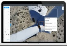
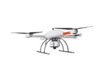
EarthCam will be providing drone and aerial imagery services under the title EarthCam Air, which combines the company’s webcam technology with unmanned aerial vehicle (UAV) services, cloud-based storage solutions and distribution tools for sharing video content.
Founded in 1996, New Jersey-headquartered EarthCam provides live streaming video and time-lapse photography documentation for corporate and government clients. In 2015, the company says it documented $221 billion worth of construction projects. Previous projects include the 9/11 Memorial Museum, the Atlanta Falcons’ Mercedes-Benz Stadium, the Barclays Center, the Statue of Liberty and Washington Monument restorations, LaGuardia Airport, and the Minnesota Vikings’ U.S. Bank Stadium.
EarthCam has a staff dedicated to the drone initiatives and plans to match Federal Aviation Administration-licensed pilots with professional videographers and engineers. The team will capture data-driven imagery for construction management and video content for sales and marketing teams.
“When UAVs are combined with webcams, a powerful geospatial model emerges,” says Brian Cury, CEO and founder of EarthCam. “Throughout our own construction process, we have discovered that when combined with terrestrial webcams, photography documentation and 3D imaging, utilizing a point cloud derived from EarthCam Air’s UAV flight data, we can deliver a comprehensive analytical report with countless benefits.”


