The National Transportation Safety Board (NTSB) determined today the operator of a drone that collided with an U.S. Army helicopter in September failed to see and avoid the helicopter because he was intentionally flying the drone out of visual range and did not have adequate knowledge of regulations and safe operating practices.
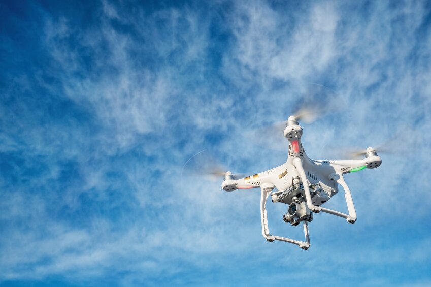
According to a press release from the NTSB, the incident took place near Hoffman Island, N.Y., on Sept. 21, when a DJI Phantom 4 small unmanned aircraft system (sUAS) and a U.S. Army Sikorsky UH-60M Black Hawk helicopter collided at an altitude of about 300 feet.
The final report on the accident states that even though the helicopter pilot saw the drone and “immediately applied flight control inputs,” he did not have enough time to avoid the crash. The report also states there was “no evidence of any mechanical or software problems with the sUAS relevant to the flight.”
The helicopter landed safely; the drone was destroyed. The NTSB says a 1.5-inch dent was found on the leading edge of one of the helicopter’s four main rotor blades, and parts of the drone were found lodged in the helicopter’s engine oil cooler fan.
The federal agency claims the sUAS operator was unaware of the collision until an NTSB investigator contacted him. The operator was also not aware of temporary flight restrictions (TFRs) that were in place at the time because of presidential travel and a United Nations General Assembly session, the NTSB adds.
“In his interview, the sUAS pilot indicated that he was not concerned with flying beyond visual line of sight, and he expressed only a general cursory awareness of regulations and good operating practices,” the final report says.
The report also notes that the sUAS pilot was a recreational operator who “flew only DJI products” and “had ‘a lot’ of experience with sUAS.” His data logs had shown 38 flights in the prior 30 days, and he had “taken no specific sUAS training other than the tutorials that are included in the DJI GO4 operating application.”
“When asked about specific regulations or guidance for sUAS flights, he stated that he knew to stay away from airports and was aware there was Class B airspace nearby,” the report continues. “He said that he relied on ‘the app’ to tell him if it was OK to fly. He stated he knew that the aircraft should be operated below 400 ft. When asked about TFRs, he said he did not know about them; he would rely on the app, and it did not give any warnings on the evening of the collision. He said he was not familiar with the TFRs for the United Nations meeting and Presidential movement.
“When asked, he did not indicate that he was aware of the significance of flying beyond line of sight and again stated that he relied on the app display,” the report continues. “He said he did not see or hear the flight of helicopters involved in the collision but said that helicopters fly in the area all the time.”
Furthermore, because the tablet the drone pilot was using did not have a cellular data connection, the Geospatial Environment Online (GEO) feature of the Phantom 4 could not show TFR information “in real time at the takeoff location,” the report says.
“In order for the system to have warned the pilot, he would have had to connect to the internet at some point while the TFR was active; however, at the time of the incident, the TFR system within DJI GEO and displayed to customers through DJI GO4 was not active,” the report claims.
The report then points to DJI’s decision to disable the feature during this time:
“During August 2017, an issue was identified with the GEO function that inadvertently and intermittently rendered the self-unlock feature for certain TFRs ineffective for some users. After a significant number of complaints about the problem, DJI decided to temporarily disable the TFR functionality in GEO until the feature was investigated and confirmed to be working properly.
“Therefore, at the time of the incident, no TFR information was available in GEO,” the report says. “Since GEO is meant to be an advisory system to pilots, DJI decided it was better to disable this feature until the problem could be corrected to enable authorized users to support recovery efforts and other authorized missions across the country, including firefighting response and demonstrations at air shows. There was no notice or advisory to users that this advisory function had been disabled. The TFR functionality in GEO was restored in October 2017.”
The full investigative report is available here.


