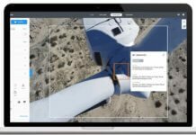
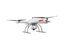
Photogrammetry software developer SimActive Inc. says GeoFIT Americas, a subsidiary of France-based Groupe FIT, has purchased SimActive’s Correlator3D software to use for imaging processing from unmanned aerial vehicles (UAVs).
Suited for sizable mapping projects, Correlator3D generates geospatial data from satellite and aerial imagery.
Groupe FIT and its affiliated companies provide geomatics, surveying, mapping, geodesy, dimensional metrology, and other solutions to land developers, land administrators, spatial planners, architects, engineers, contractors, facility managers and industrialists. The company has several branches in France, Tunisia, Morocco, Senegal, Burkina Faso, Panama, Ecuador and Canada.
“With our acquisition of a high-end drone, we needed comparable software to complete our solution,” explains Sylvain Laroche, operations director of GeoFIT Americas. “Following analysis of various solutions on the market, the SimActive product rapidly emerged as our choice.”


