While much has been written about the impact of drones and artificial intelligence in property/casualty insurance over the last few years, the first real test of these emerging technologies didn’t occur until the 2017 hurricane season.
After Hurricane Irma battered Florida, reinsurers and insurers of all sizes (small, midsize and top 10) looked to facilitate their claims processing through the use of drones and artificial intelligence.
One of the most critical factors in post-catastrophe claims processing is capturing and documenting the situation on the ground. Traditionally, this is done using on-the-ground claims adjusters and is supplemented by imagery captured from airplanes or satellites.
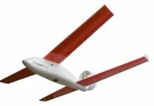
One of the benefits of drones is that they can quickly and safely capture many high-resolution photos after catastrophes. Unlike satellites or airplanes, drones can fly a few feet away from the surface of a home, apartment building, high-rise or even stadium to document the damage to the top and sides of these structures.
Using Betterview’s on-demand drone pilot network, our customers were able to request drone inspections as claims came in, while Betterview mobilized its pilot network, obtained Federal Aviation Administration (FAA) clearances (usually within 24 hours) and created flight plans.
“While the FAA had flight restrictions in place to ensure the safety of manned aircraft engaged in disaster relief operations, the System Operations Support Center of the FAA was operating in full force to provide authorizations for unmanned aircraft operations within restricted areas,” says Armin Monajemi, chief pilot and solutions engineer at Betterview. “The FAA’s staff was very responsive and helpful in providing these authorizations. In most cases, we had the authorization letter back in the same day.”

Working with the FAA, Betterview’s in-house team developed new flight plans for Florida. Normally, flight plans for claims are extremely detailed and usually capture tile-by-tile detail. Due to the volume of potential claims, our customers were looking to expedite the claims process for their clients by identifying full or partial losses and capturing the right amount of imagery for documentation, analysis and reporting.
Once Betterview was granted FAA clearances, our on-demand pilot network executed the new flight plans. At the conclusion of each inspection, the high-resolution imagery captured was securely uploaded into the cloud. From there, our artificial intelligence and in-house team of adjusters reviewed each photo to identify any potential issues:
- Missing or damaged roof panels, tiles and shingles;
- Rips, tears and wrinkles in TPO and EPDM roofs;
- Damage to building facades and flashing; and
- Debris on roofs and inside gutters.
After analyzing the photos, tagging any issues and adding notes, the team generated a high-level summary report for each claim.
For many of our customers, Hurricane Irma was the first time drones were used for catastrophe response. The ability of drones to quickly capture high-resolution imagery for documentation and analysis purposes allowed our customers to proactively communicate with their clients about the extent of their losses, educate them on next steps, and most importantly, accelerate the claims process for them.
Hurricane Irma demonstrated the value of drones in catastrophe response, as well as showcased how the insurance industry is willing to embrace the latest technology in order to benefit their clients.
This blog was reposted with permission from Betterview, a San Francisco-based provider of drone-based property inspections. David Lyman is CEO and co-founder of Betterview.


